CAMPUS POMPEII
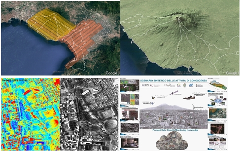
2017 – 2014 | Mapping, Monitoring, Surveying, Complex Representation with restitution on GIS database of the territory of Pompeii and of the F3 area “Golden Mile-Torrese-Stabiese”. CAMPUS Pompeii project. Campania Region (FESR 2007/2013). Fire and hydrogeological risk prevention of the Vesuvius National Park and F3 Area F3, survey with sampling of environmental radiometric measurements, surveys carried with ultra-high resolution hyperspectral and optical sensors for mapping infrastructures, landfills and illegal micro-landfills; land use maps and perimeter of nitrate vulnerable areas. Financed project: Campania Region Administration Project “Urban ecotourism for the sustainable use of the Cultural Heritage in Campania “, in implementation of the Operational Objectives 2.1 and 2.2 of the FESR Campania Region Administration 2007/2013 Operational Program.
For more info: campuspompei.it

